ArcheoFOSS 2022
Backward engineering historical maps: the case of 18th century gazetteer of the Napoleonic map of Egypt
Julian Bogdani
LAD, Sapienza University of Rome, Rome, Italy
Domizia D'Erasmo
LAD, Sapienza University of Rome, Rome, Italy
Panel: Maps to the past. Open digital approaches to the investigation of historical maps.
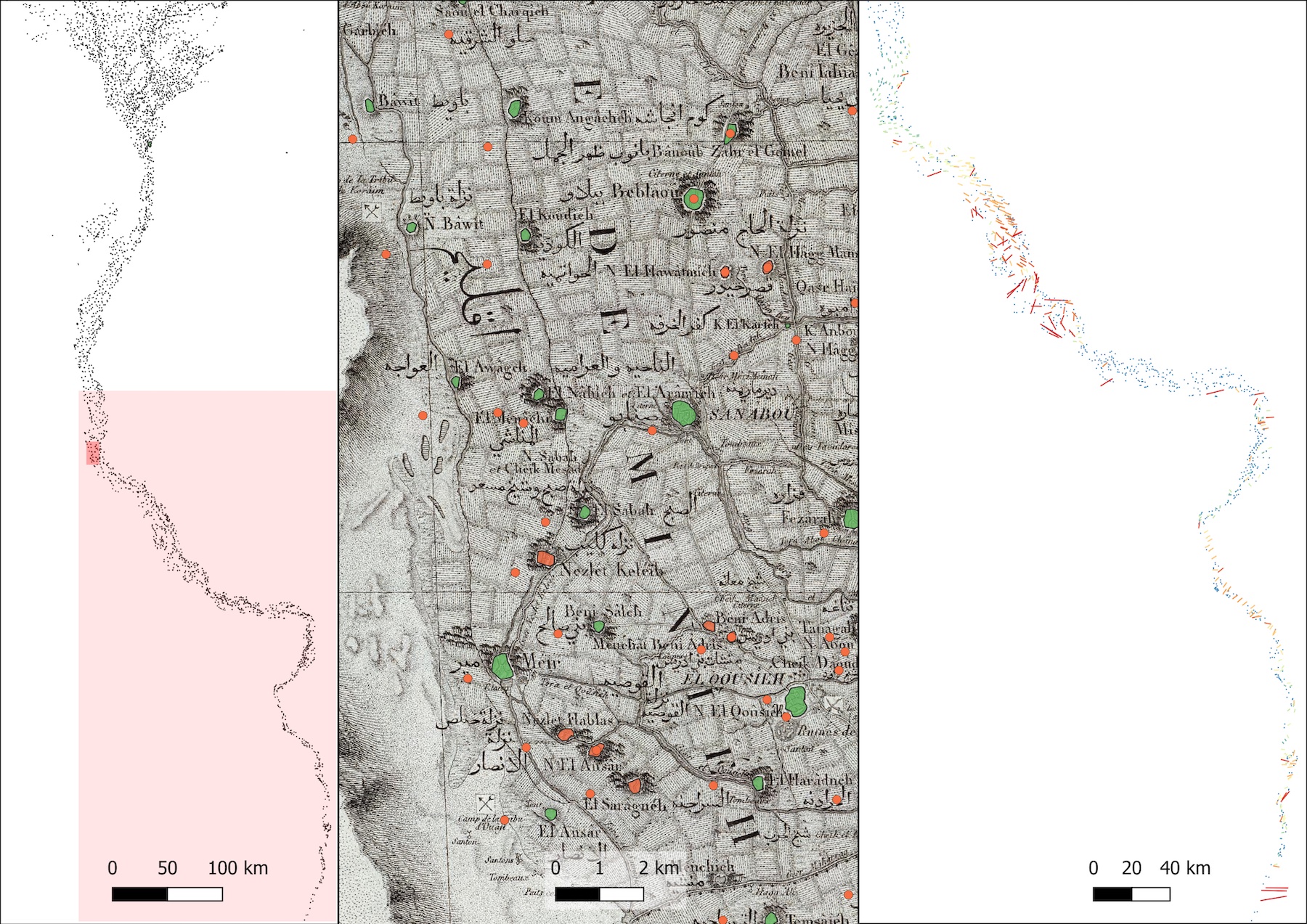
The Carte Topographique de l’Égypte edited in 1818 by Pierre Jacotin, the chief cartographer of the Napoleonic team of savants accompanying the ill-fated French invasion of Egypt, is a fundamental historical document to the understanding of pre-modern Egypt. It is important to science historians, geographers, historians of the modern period, but also to archaeologists working in Egypt, since it is a testimony of a country that has undergone radical changes since then.
The team of LAD: Laboratory for Digital Archaeology at Sapienza (https://lad.saras.uniroma1.it) has dedicated to this document a great attention, in the context of its collaboration with PAThs: Tracking Papyrus and Parchment Paths. An Archaeological Atlas of Coptic Literature, an ERC-Advanced project directed by Paola Buzi and based at Sapienza University of Rome (http://paths.uniroma1.it).
An open repository of georeferenced historical geospatial data has already been published, offering free access to the entire data sets processed and created by PAThs to the scientific community (https://docs.paths-erc.eu).
The Napoleonic map of Egypt offered a fertile ground for further research from different points of view. The principal aim behind its georeferencing and vectorisation was to obtain from the published map a source of structured, GIS-ready, and well documented spatial data that could be openly shared with the scientific community.
While the hydrographic network is of paramount interest, due to the important changes that water system has experienced in the last two hundred years, not only to the understanding of the land use and communication network, the place(name)s also attracted our interest.
This presentation will specifically focus on the gazetteer that has been extracted from the map and the several steps of processing that it has undergone to be georeferenced and linked to other, both present-days and historical gazetteers. The work is not completed yet, and new frontiers appear as soon as specific tasks are being closed. Nevertheless, the current state of progress has been published and is being periodically updated on GitHub. In order to facilitate the visualisation of data by people not very comfortable with GIS technologies, a web-based interactive visualization of the available data is also being maintained and can be found at https://lab-archeologia-digitale.github.io/jacotin-1828/.
All available data sets (and their different versions) are released with CC BY-SA 4.0 International License and are being deposited for long term preservation and DOI assignment in Zenodo.
License
Texts and image are released under CC BY-ND 4.0 International license. Copyright: Julian Bogdani and Domizia D’Erasmo 2022.