ArcheoFOSS 2022
Between archeology and conservation. Digital tools for digital bridges between disciplines: The risk map of the in situ mosaic and marble surfaces of the Parco Archeologico del Colosseo
Federica Rinaldi
Parco Archeologico del Colosseo, Rome, Italy
Alessandro Lugari
Parco Archeologico del Colosseo, Rome, Italy
Francesca Sposito
Free lance consultant, Rome, Italy
Ascanio D'Andrea
Free lance consultant, Rome, Italy
Panel: Practice and Paradigms of Open Source Technologies for Archaeological Field Data.
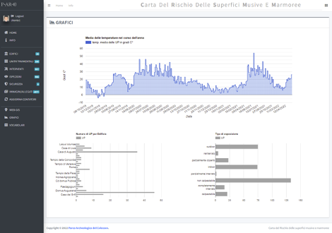
Starting from 2018 the Parco Archeologico del Colosseo set on a three-year basis project, the “Risk Map of Floors Surfaces”, with the aim of preserving and monitoring all the in situ floor coverings of the Roman Forum and the Palatine Hill areas (mosaics, sectilia, cement floors, spicata). In order to systematically address this methodological approach, a team of archaeologists, architects and restorers created a functional system, the “Risk Map of the Mosaic and Marble Surfaces”, a web-based application with integrated webGIS tools, for the recording of historical-archaeological and archival data, essential to build a hierarchy of interventions in the field, and capable of moving from extraordinary maintenance to a continuous cycle of routine maintenance.
The test of the monitoring sheet continued simultaneously with the field activities: the field operation guided its improvement in order to better adapt it to the recording of all maintenance, cartographic and photographic data. The information collected during the fieldwork revealed the need to be equipped with a tool capable of managing, archiving and synthesizing the mass of data, and led to the implementation of the GIS. The Information System has been designed on the real needs of professionals and is proving to be a valid tool for the optimization and integration of conservation and archaeological data with operational activities, with a view to medium and long-term action and programming.
The web application is based on a standard Postgresql/PostGIS database and provides operational tools and data analysis through graph visualizations and a webGIS interactive map. The improvement achieved with this kind of digital tool must be seen mostly towards its dynamic approach to data collecting on the field focused on user needs, in order to connect, relate and inform conservation practices to archaeological information of the ancient floors. This kind of “connected” approach was able to trigger the correct awareness on heritage values and significance in order to create the right balance between conservation and enhancement needs.
At the end of the first three-years phase of the project, an interactive web map has been published online in May 2022 in order to share with public users selected data related to the ancient floors of the Parco. The webmap (https://cdrweb.parcocolosseo.it) allows, at this stage, to get descriptive texts and a gallery of images of the ancient floors and it is planned to improve data sharing in the near future through an API and web map services.
License
Texts and images are released under CC BY-ND 4.0 Internatinal license. Copyright by Parco Archeologico del Colosseo 2022