ArcheoFOSS 2020
Rome - Northeastern Palatine slopes: open-source methodologies and tools for the analysis of ancient architectures
Lorenzo Fornaciari
lorenzo.fornaciari88@gmail.com
Lorenzo Fornaciari graduated in Methods of Archaeological Research at the Sapienza University of Rome and now PhD student in Methods and Methodologies of archaeological and historical-artistic research at the University of Salerno with a research project about analysis and reconstruction of ancient landscape and buildings of the NE Palatine slopes in Rome. From 2016 he is responsible for graphic documentation, survey and GIS at the NE Palatine Slopes excavation and he has also worked as survey expert within the Major project Pompeii.
Emanuele Brienza
Emanuele Brienza graduated in Methods of Archaeological Research and made his PhD in Classical Archaeology at the Sapienza University of Rome. From 1990 to 2014 he was responsible for survey and GIS at the Meta Sudans and NE Palatine Slopes excavations in Rome. From 2000 to 2010 he was Survey and GIS Senior Expert for Pisa University in Egypt. He has also worked as GIS and survey expert in Turkey and has been Senior Consultant in archaeology for the Ministry of Culture of the North Macedonia Republic. Since 2012, he has been a researcher and Assistant Professor of Methods of Archaeological Research at the Kore University of Enna.
Giovanni Caratelli
Giovanni Caratelli archaeologist and researcher at the National Research Council of Italy - Institute of Heritage Science (CNR-ISPC), mainly deals with archaeological survey and technical, stratigraphic and typological analysis of ancient monuments; he was scientific director of the Museo della Città e del Territorio di Cori.
Cecilia Giorgi
Cecilia Giorgi, archaeologist and researcher at the National Research Council of Italy - Institute of Heritage Science (CNR-ISPC), specialized in archaeological survey, direct and instrumental, 3D modelling, analysis of ancient monuments.
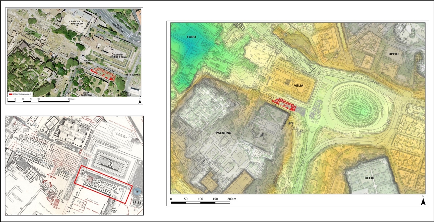
The area of the north-east Palatine hill slopes in front of the Colosseum valley has been the place of a more than 30 years long archaeological research, that brought to light to many archaeological evidences and material remains of ancient buildings and monumental interventions of great impact inside an environmental, topographic and stratigraphic continuum.
The huge amount of documentation produced has required the development of a data storage and management system dedicated to give a logic and integrated framework to information but also able to propose new elements for research development. Since 2001 the whole archaeological record has been managed by an intra-site GIS for data-retrieving, spatial analysis and archaeological reconstruction.
During the research this system has been implemented in contents but also in technology, following the advent of new IT products. In particular we dedicated our attention to the spread and availability of open-source software and ArcheoFoss: this in the last years, together with the support of a community of professionals and developers, undoubtedly has represented a fundamental pivot of technological development in archaeological practice with increasing interest and participation.
Our research follows this approach paying great attention to open-data issues and experimenting with entire datasets migration reconstructing the entire system in Qgis open-source platform. This process has addressed not only technical problems? , related to the nature of some proprietary formats, but also, and above all, has generated new reflections on the possibility of renewing methods and techniques for collecting, managing and analyzing data.
Focusing on the study of the ancient building, the use of image-based-modeling photogrammetry techniques revealed a certain inadequacy of the exclusively chrono-typological study of the ancient walls. In fact, these approaches, being anchored to two-dimensional projections of the artefact, inevitably neglect factors related to the three-dimensional environment of structures.
From these reflections, while we were making a new 3D documentation of the ancient walls, in this last 2 years we have performed also a new and integrated recording of the structures, having planned a new form format by criteria aimed at the collection of information related to construction methods, structural expedients, yards dynamics, specific materials selection, quantification of the work in terms of time and number of the workers.
This new file-card format for ancient masonry contexts, for data display, entry and editing, was created directly by Qgis. For the contents homogeneity and to facilitate data entry procedures, we have encoded standardized terminologies; in addition, the detailed metrics information and statistics, derived from the analysis of the samples of wall facades, are managed by accessory modules.
All these data are linked to 3D documentation of masonry stratigraphy: in detailed level for the evaluation of single walls and samples; in a general framework level for diachronic and typological evaluation of the architectural complexes of the area.
An external connection with the open-source software CloudCompare is a first attempt to show the graphic quality of the photogrammetric acquisition and to partially overcome the 2.5 dimensional perspective of GIS. Finally, particular attention was paid to the question of the “philological transparency” of data considered like the “basement” of archaeological interpretation. In order to deal with this problem, we have reproduced a new system for collected data analysis and retrieving: photos, 3D models acquired from scratch, sections and elevations, hand-made drawings and all raw data produced during the excavation; through several queries it is now possible to analyze all the recording and elaborations steps made for stratigraphic interpretation.